
PTOLEMY.
WITH MS. LOVE POEM

Geographia
Venice, Vincenzo Valgrisi, 1562£12,500.00
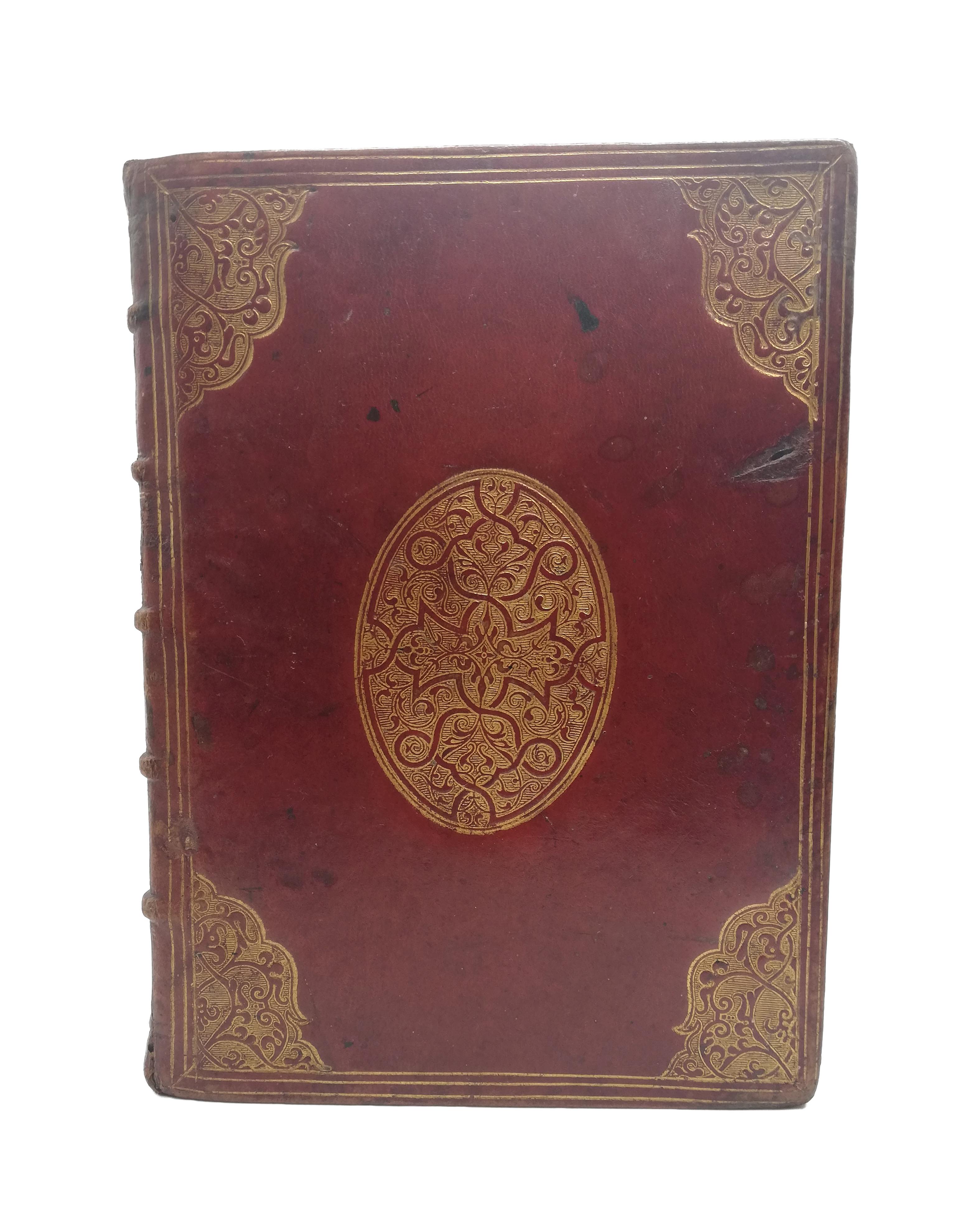
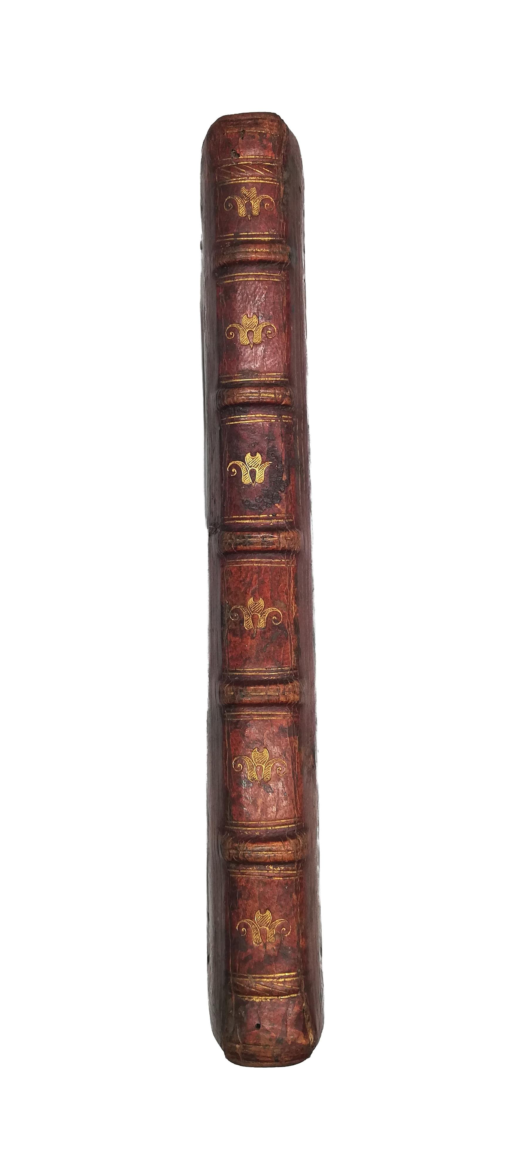
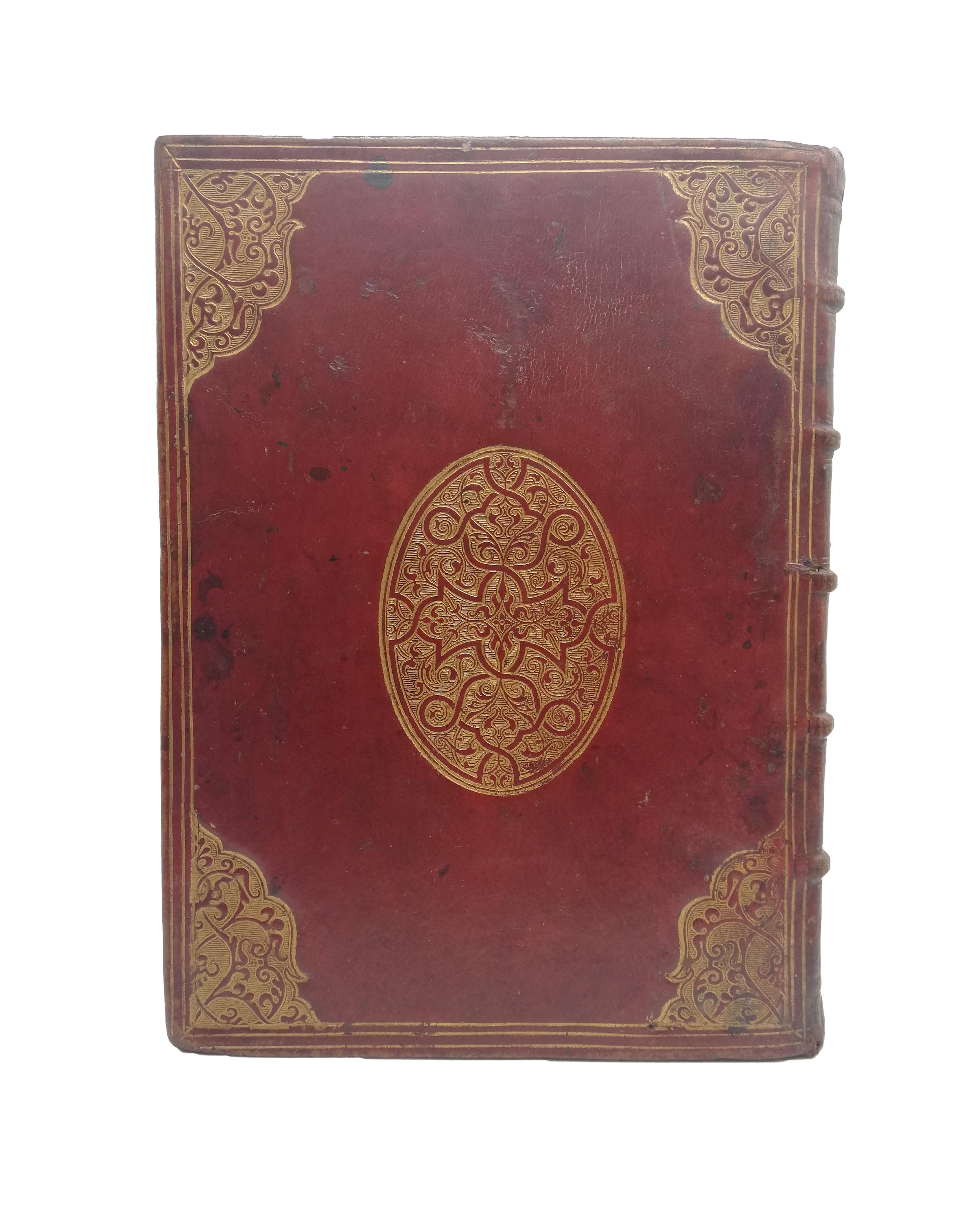
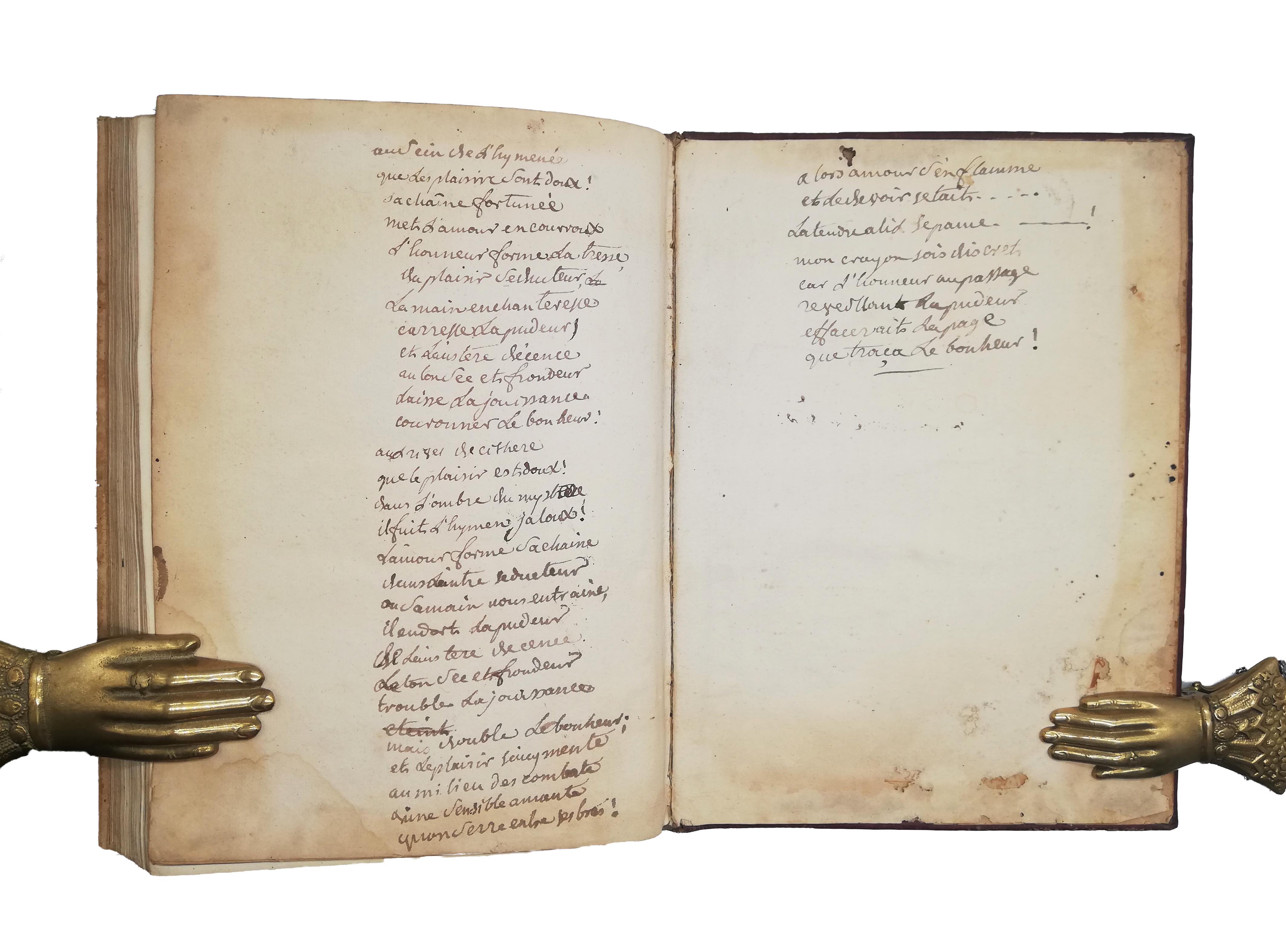
FIRST EDITION thus, 4to, 4 blanks, 64 double page engraved maps, 7 blanks. Text ll. excised. Italic letter. Maps depicting the world, continents, states and seas, several diagrams summarising geographical information. Occasional marginal inking, a couple of lower outer edges lightly waterstained, all ll. stub mounted. An excellent copy in contemporary red French morocco, covers triple gilt ruled with arabesque centrepiece and cornerpieces, cover’s edges gilt, spine with double gilt ruled raised bands, gilt flowers in compartments, a.e.g. C20 (ms. in pencil) and late C19 (printed and pasted) bibliographic notes to front pastedown, armorial stamp of the Le Vicomte family (Normandy) with motto “Le Visconte e l’Enor” to fly, C18 ms. “ex libris Alexii de Crochard” to first l., in same hand “il y as dans ce livre soixante quatre cartes géographiques anciennes” at head of first rep, 36 line ms. French verse c. 1700 to last two blank ll.
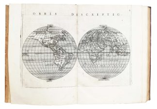
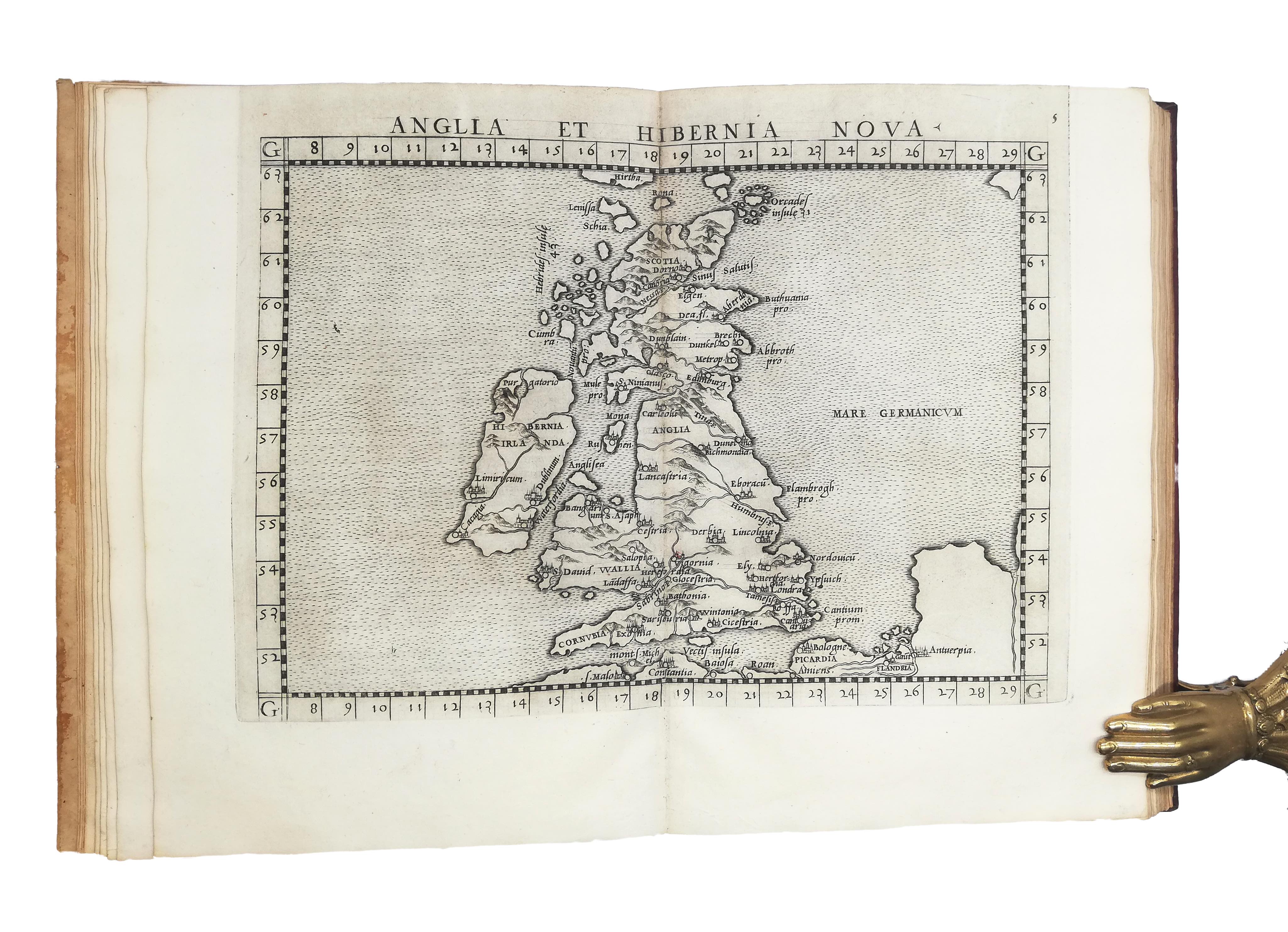
Handsome, complete set of finely engraved maps extracted from the first edition of Giuseppe Moleto’ Latin re-translation of Ptolemy’s Geography. An Italian mathematician, Moleto (1531-1588) revised and annotated the text of Pirckheymer’s previous translation (1525) on the basis of various Greek manuscripts. Claudius Ptolemy of Alexandria (c.100-170 AD) is regarded as the most influential ancient astronomer. His ‘Geographia’ is an atlas and a treatise on cartography which constitutes a fundamental compendium of the geographic knowledge of the Greco-Roman world.
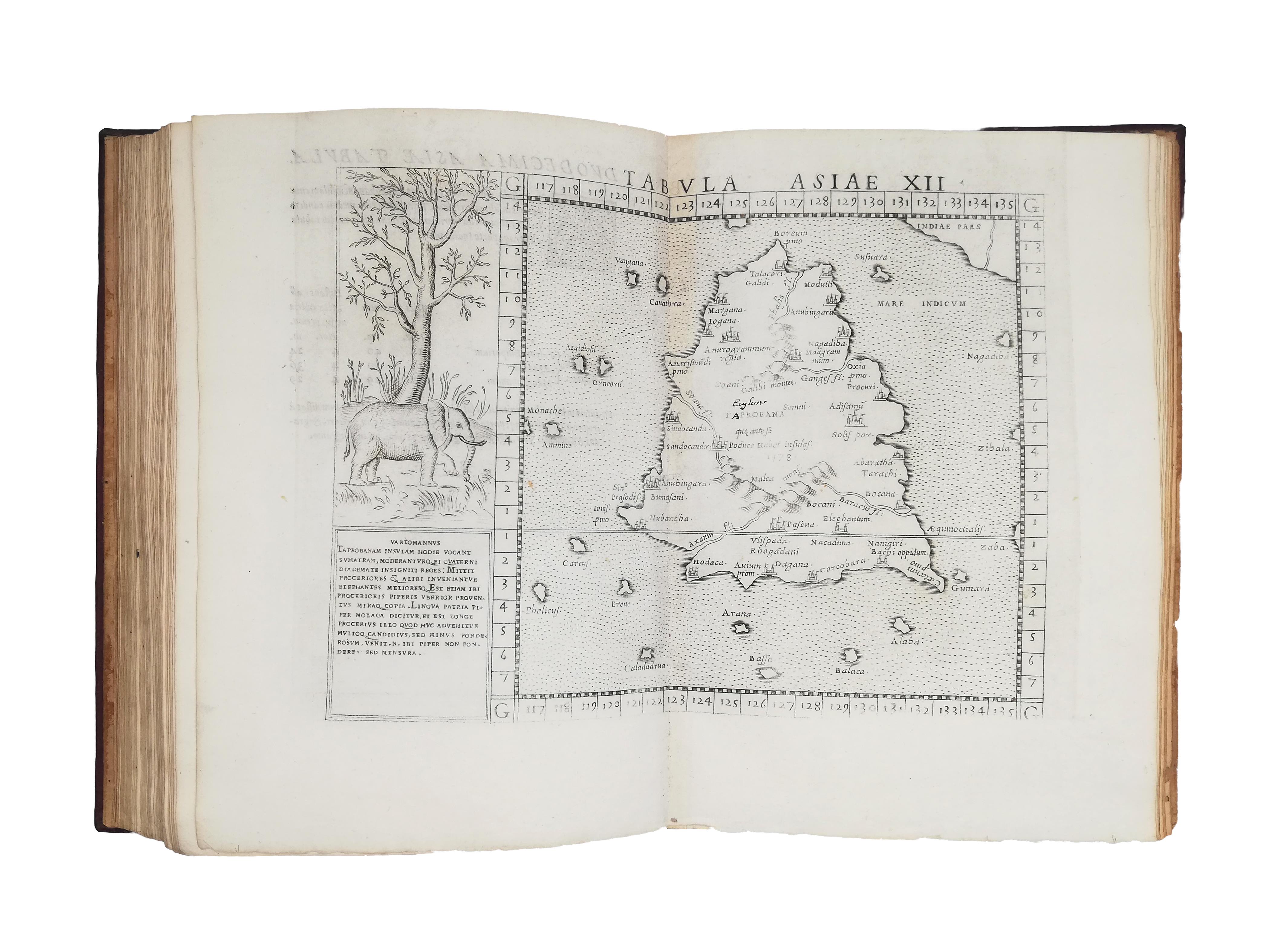
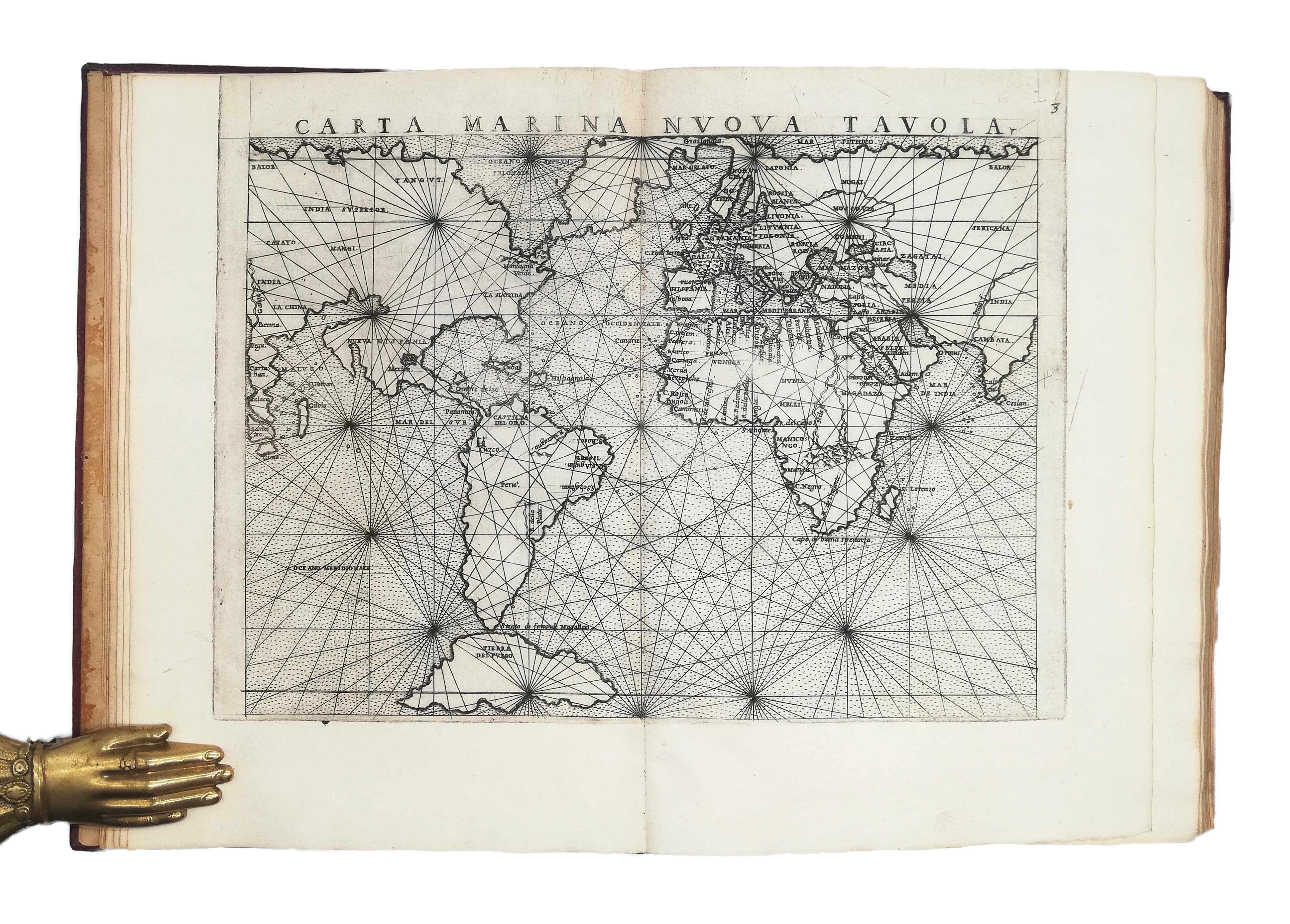
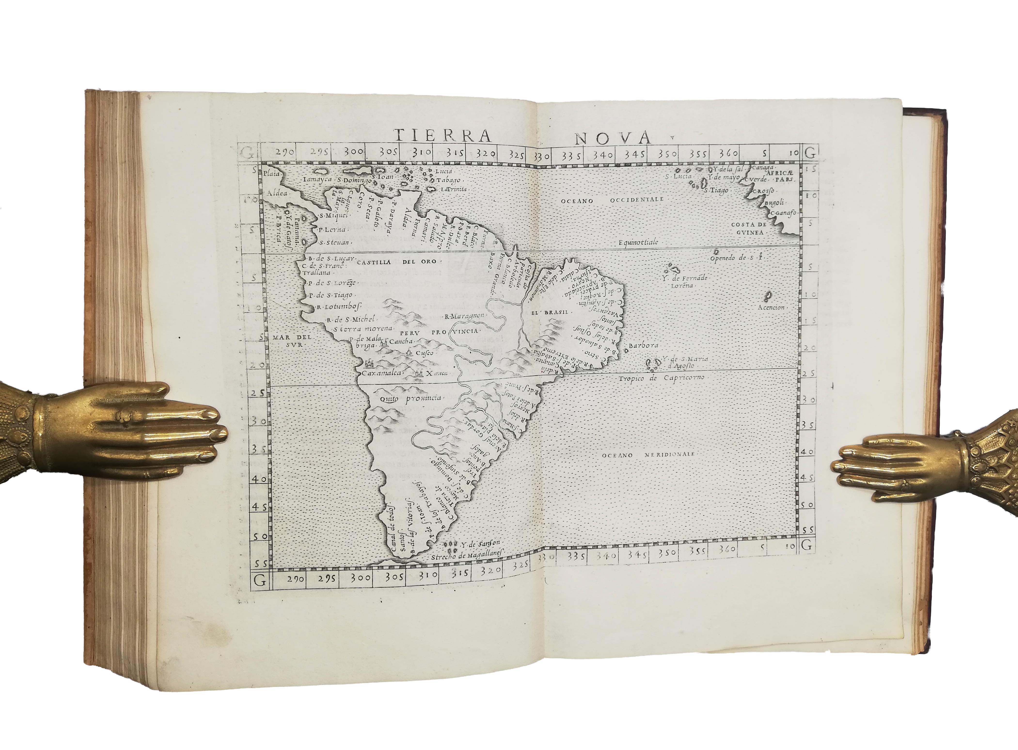
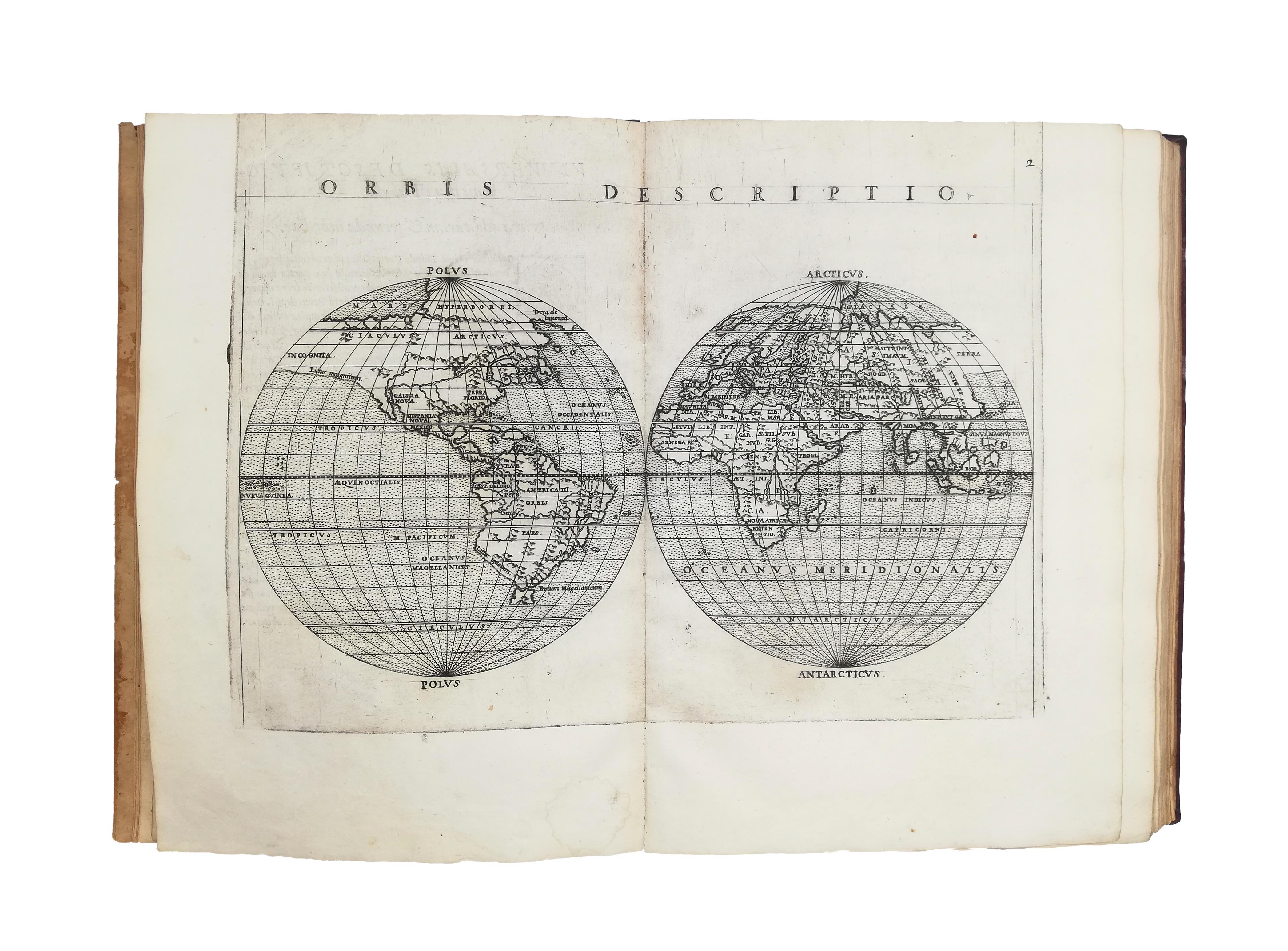
The 64 excellent copperplate maps are reproduced from the Italian edition by Girolamo Ruscelli printed by Valgrisi the year before, with very minor differences. These maps were engraved by the Venetian Giulio Sanuto under the direction of his brother, the cosmographer and cartographer Livio Sanuto (1520-1576). There are 27 old Ptolemaic maps and 37 new ones. The first plate shows Ptolemy’s famous map of the world, while the second plate, depicting the world divided into two hemispheres, is considered by Nordenskiöld to be the first such map to appear in an atlas. The third map represents the World’s hydrography, and it is followed by several maps illustrating Europe, Africa, Asia and north and south America, many focusing in detail on their countries and regions. Remarkably, plate 58 – which contains a map of Sri Lanka – includes a charming illustration of an elephant and it is the only one accompanied by a similar decoration.
From the end of the 15th century, the ‘de Chrochard’ family was one of the noble families of Anjou, in north-west France. The ex-libris on this copy most likely belongs to Alexis-Hyacinthe de Crochard, second son of Armand-Renè de Crochard, Lord of Crochadiere and Piochere, who resided with his family in La Flèche. Born in 1721, Alexis was a knight (chevalier), he died at the age of 76 in Cheviré-le-Rouge, unmarried. The ms. poem at the end, which does not appear in any published sources we have been able to consult, might be an unedited composition, possibly written by Alexis himself. The 36 verses describe, in a playful and often quite explicit manner, the encounter between two lovers. Interestingly, it appears that the author marked the ending of a couple of verses as incomplete, probably intending to conclude them at a later time.
The very fine contemporary binding, in red morocco beautifully tooled in gold, resembles some made by Claude de Picques (for example, see BL Database of Bookbindings C183b9). Personal bookbinder to Queen Catherine de Medici and later official ‘relieur du roi’ to Henry II of France (from 1556 to 1578), De Picques is credited with having designed some of the finest bindings of the 16th century.
USTC 851490; Adams P2231; Graesse V, p. 501; Shirley I, T.PTOL-10c; Nordenskiöld 217; Alden 562/25. Not in Brunet.In stock