
ADRICHEM, Christian van
SUPERB, VERY LARGE MAPS
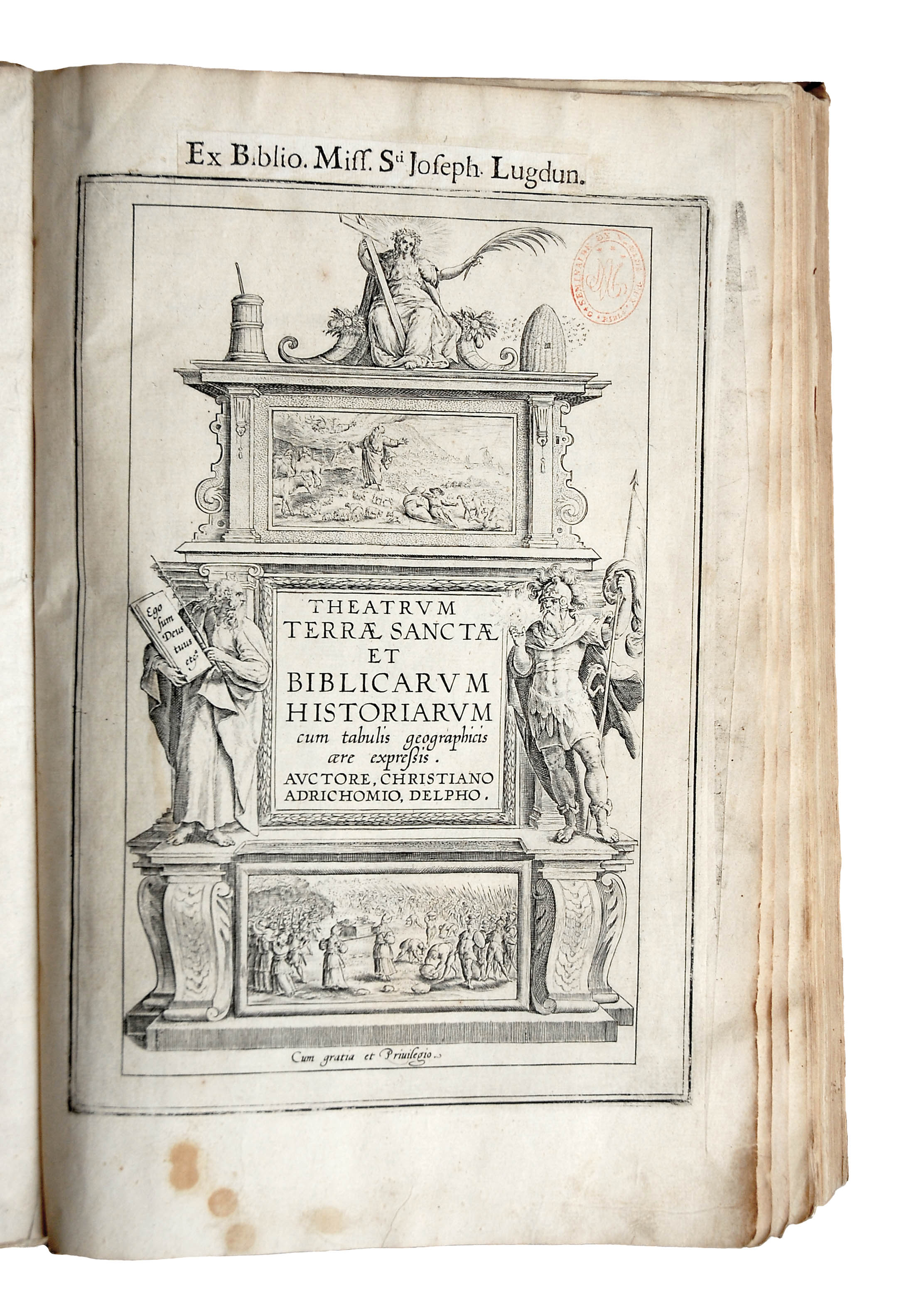

Theatrum Terrae Sanctae et Biblicarum Historiarum
Cologne, Mylius, Hermann (I.), 1628£3,950.00
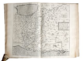
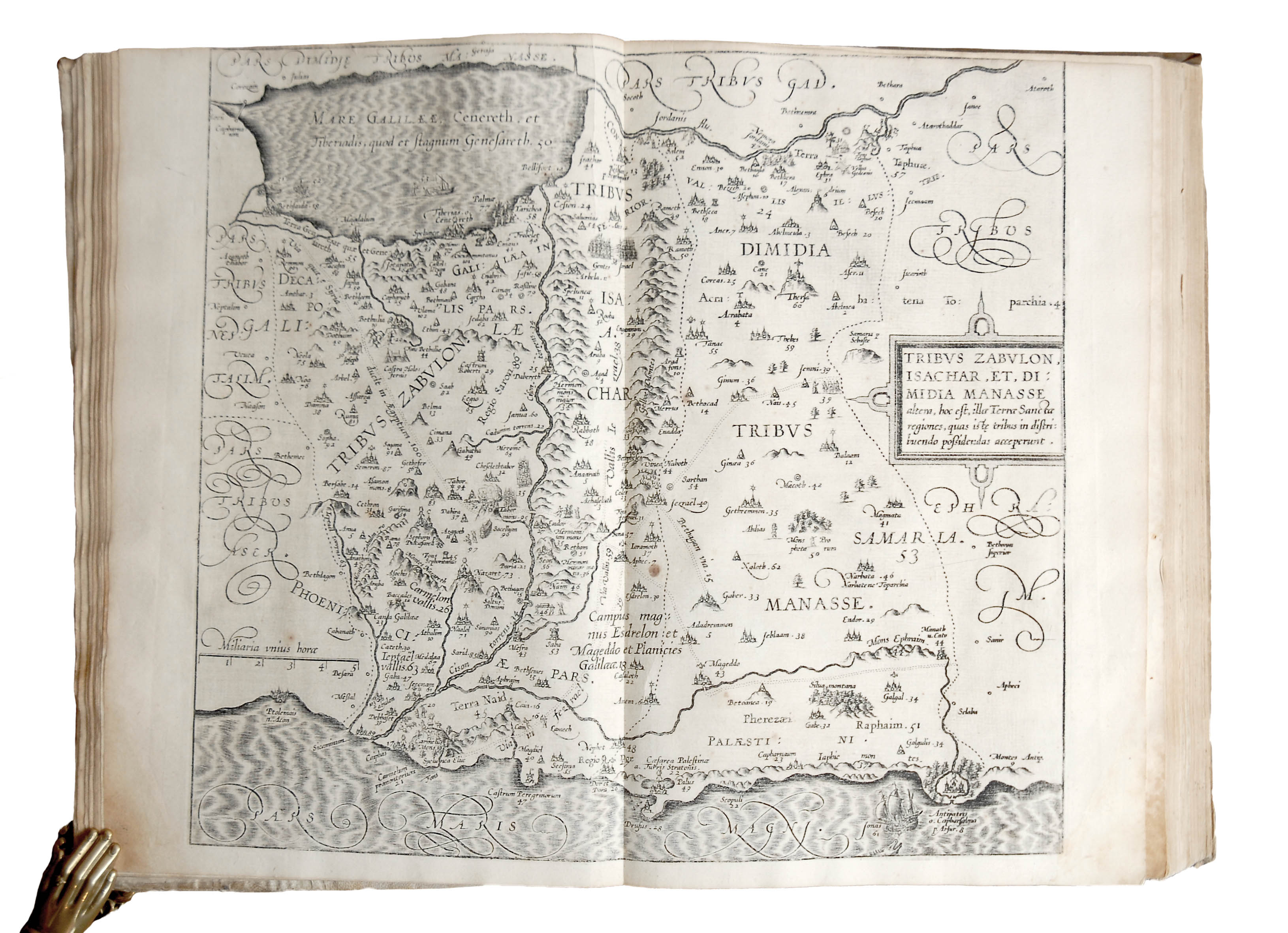
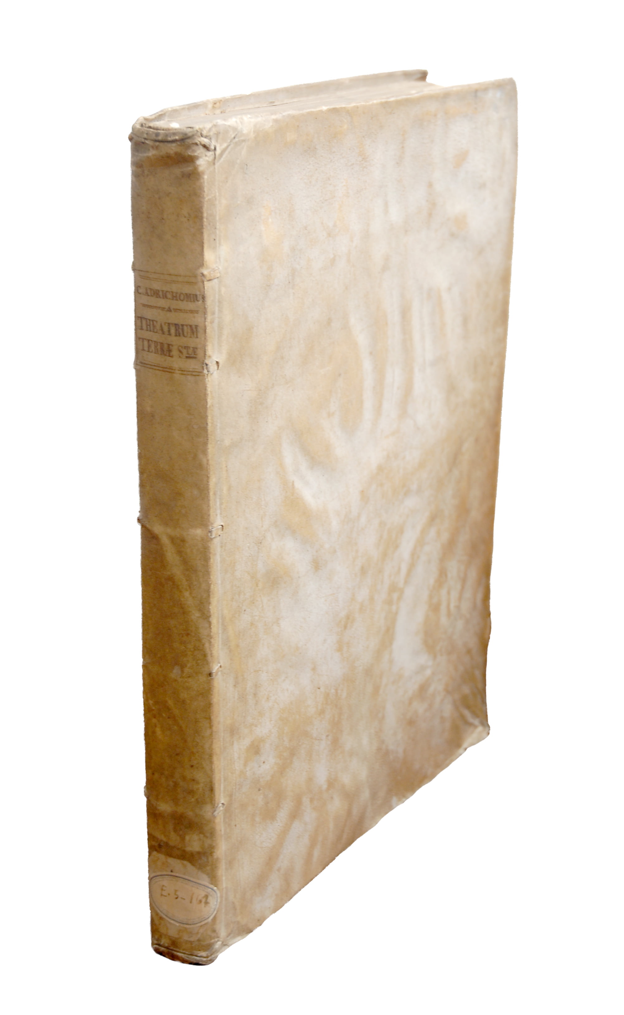
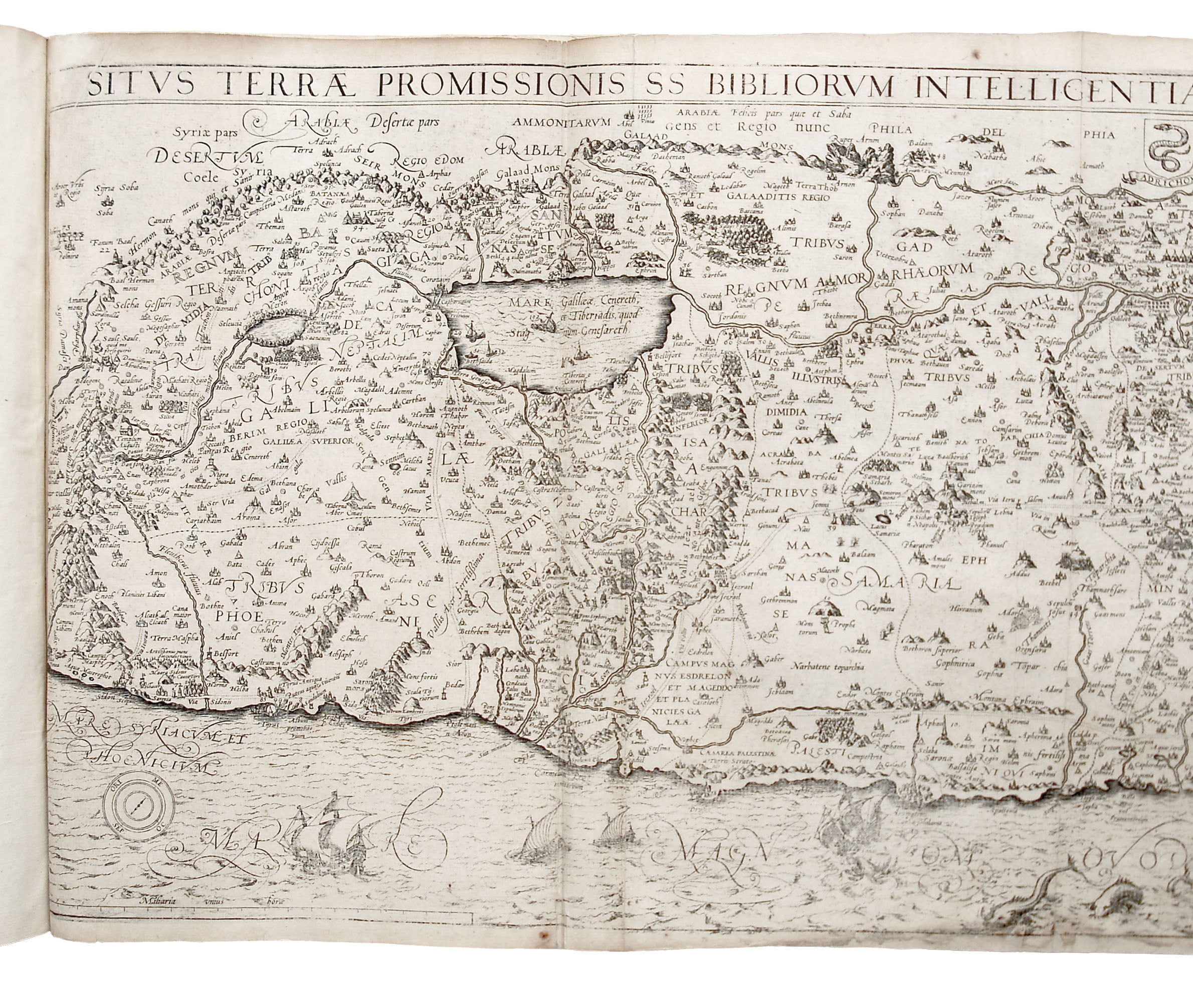
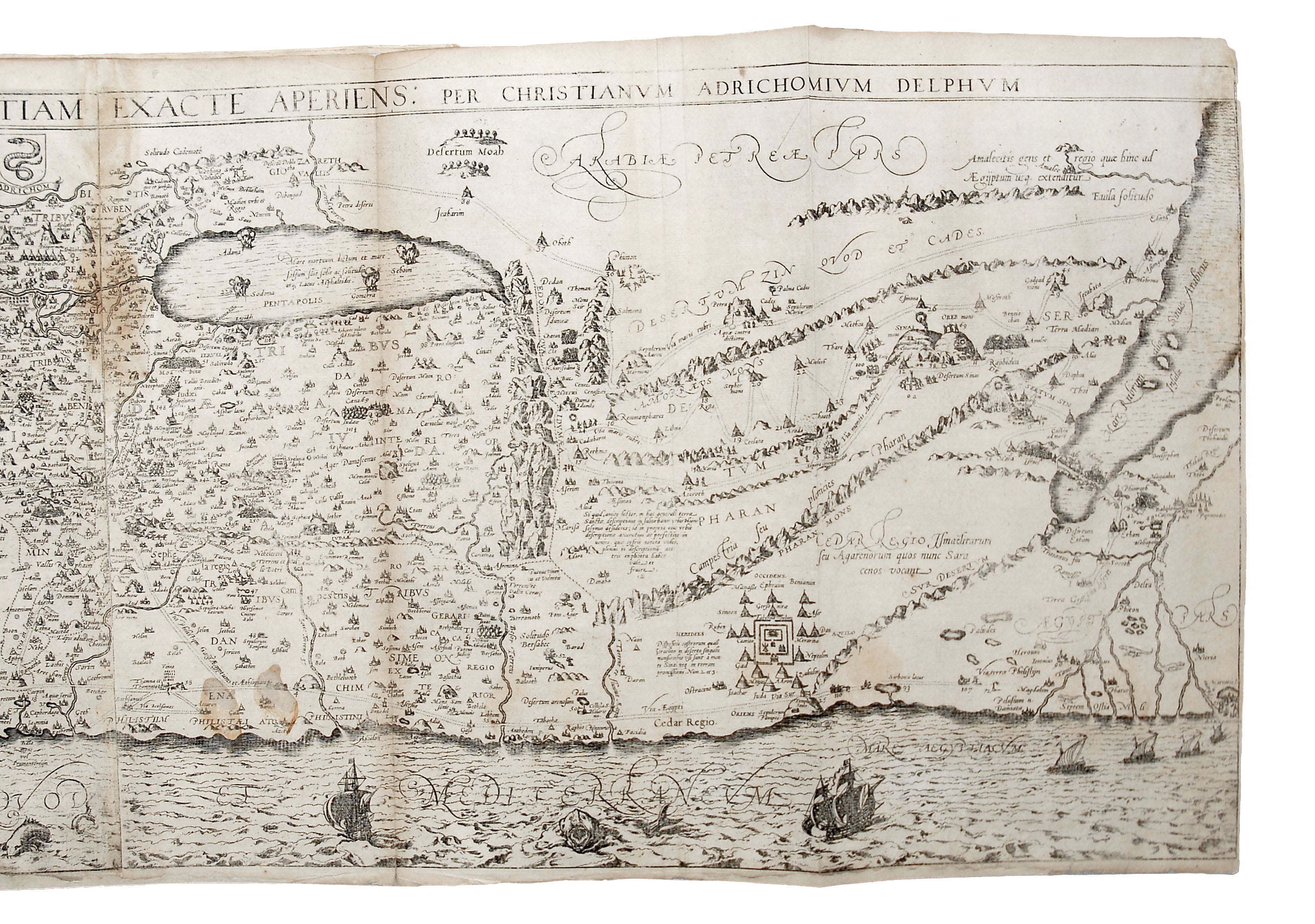
Folio. pp. (xii) 286 (xxviii). Roman letter, with Italic, 12 maps (double-page or fold-out). Attractive engraved architectural t-p with allegorical figures and biblical scenes; 7 fold-out and 5 double maps of Palestine and the allotments of the tribes of Israel; decorated initials and grotesque tailpieces. Light browning in places, intermittent light marginal oil stains, occasional spots, small paper flaw to blank section at p. 93, tiny marginal loss at p. 125, gutter of first fol. repaired. Maps generally in very good condition, occasional light spotting, slight marginal soiling or fraying with minor loss mainly at folds to 1, 8, 9 and 12, light browning to 6, 7, 8 and 11, slight offsetting to 4 and 5. A good, well-margined, very large copy in contemporary vellum over pasteboards, spine in five compartments, raised bands, contemporary inked lettering, early shelfmark label at foot, upper joint a bit loose. C17 pasted printed ex-libris ‘Ex Biblio. Miss. Sti Josephi Lugdun.’ and later red library stamp of Seminary Le Puy (Lyon) to t-p, autograph ‘Gaspar Gyrod em[ps]it sibi viginti francis. anno 1681. die 9 februarii’.
A good, lavishly illustrated and unusually complete copy, in fine impression, of this superb biblical atlas. Christian van Adrichem (or Adrichomius, 1533-85) was a Catholic theologian who was forced to flee from the Convent of St Barbara in Delft to Cologne to avoid Protestant persecutions. In addition to an historical account of the life of Christ, he published his very successful ‘Theatrum Terrae Sanctae et Biblicarum Historiarum’ (1590), of which this is the sixth edition. ‘Theatrum’ brought together theories dating back to medieval times and late antiquity—i.e., world history as sacred history; maps as texts where history and geography, time and space, coexist—as well as more recent disciplines like chorography, i.e., the illustrated study of the topography and history of specific regions. The first part provides a description of ancient Palestine and the antiquities of Jerusalem, with the visual guidance of handsome depictions of the Holy Land, the allotments of the tribes of Israel (with hundreds of cities) and a bird’s-eye-view plan of Jerusalem. The first and last of these maps are frequently missing in recorded copies but finely preserved in this one. Produced in 1584, the plan of Jerusalem is a magnificent scholarly reconstruction of the city at the time of Christ, which remained unrivalled in accuracy until the archaeological discoveries of the C19. It names walls, gates and buildings, also discussed in the text, and was also the first map to chart the location of the 14 Stations of the Cross. Inspired by ancient historiographic works like Eusebius’s ‘Chronicon’, the second part provides a chronology of world history shaped by the succession of empires and popes, from Adam to Rudolph II of Habsburg and Sixtus V. A masterpiece of Renaissance antiquarian culture.
Gaspar Gyrod was professor of theology at the Seminary of St Joseph in Lyon, where this copy was preserved.
BL STC Ger. C17, A165. Not in Brunet or Graesse. K. Nebenzahl, Maps of the Holy Land (New York, 1990).In stock